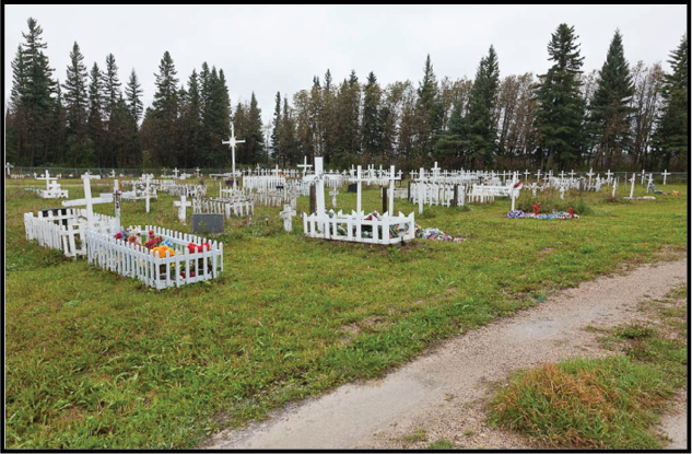
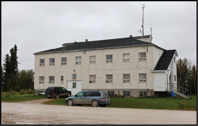
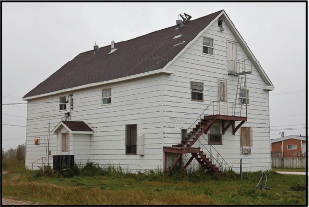
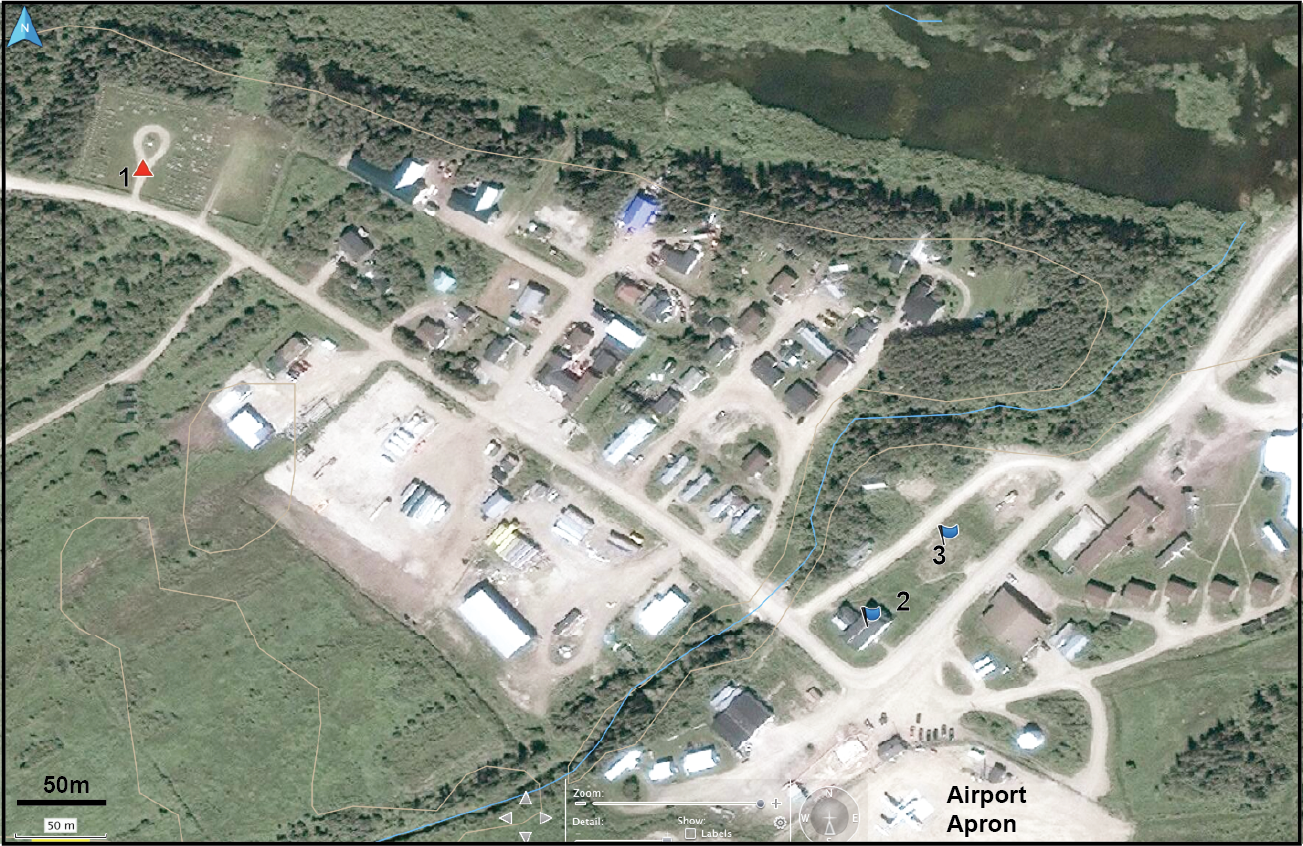
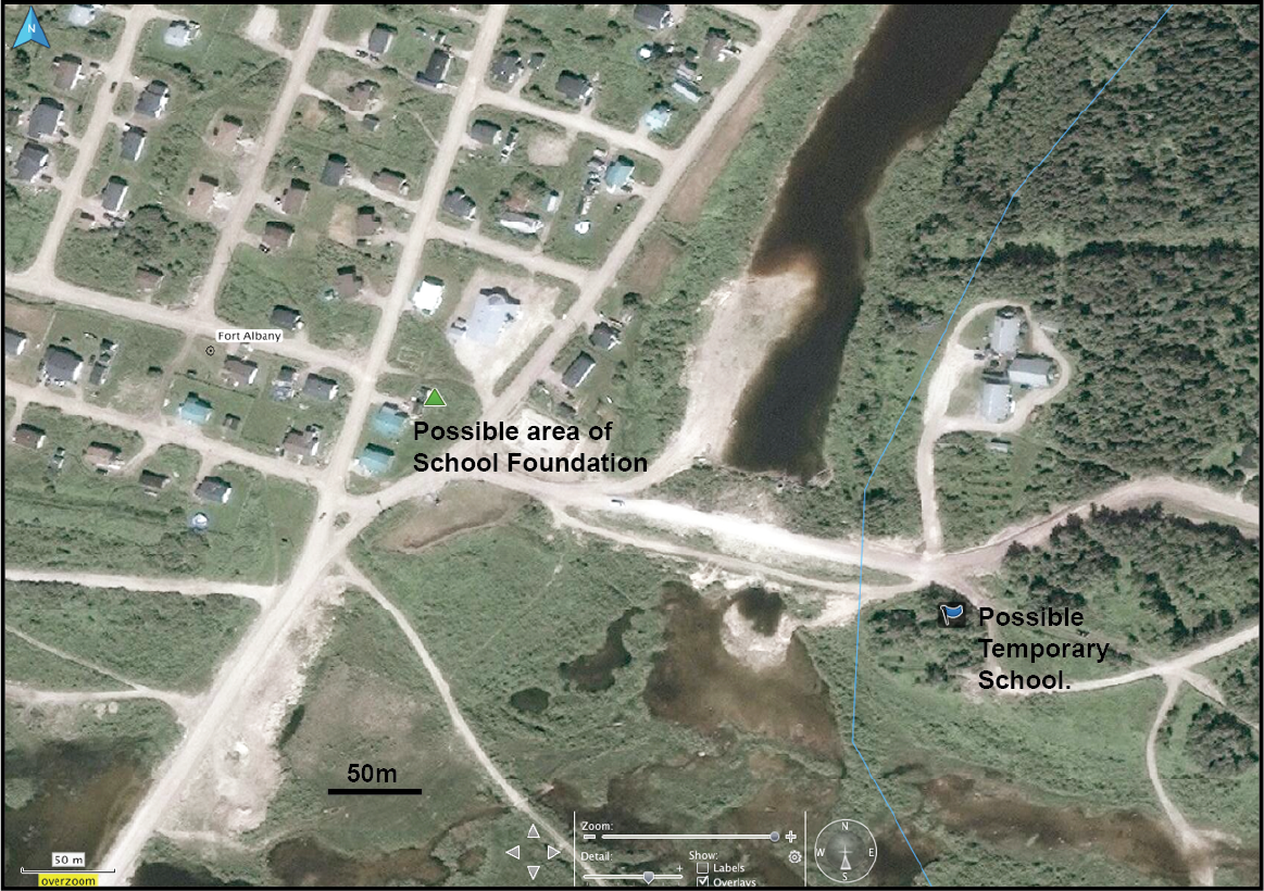
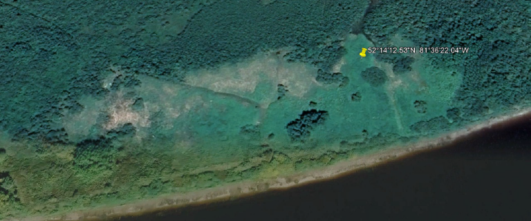
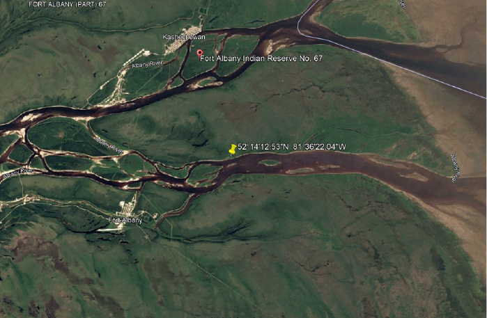
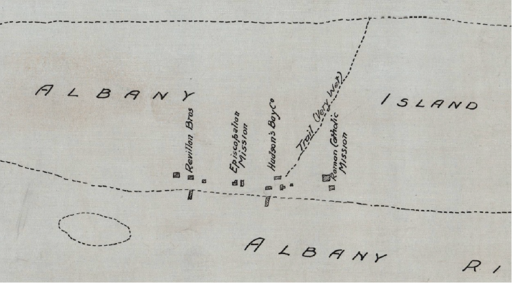
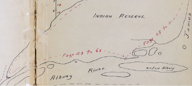
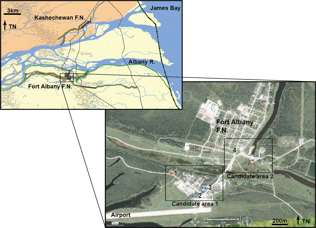
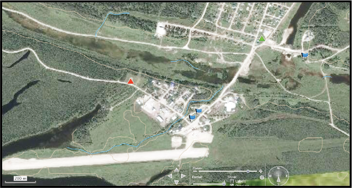
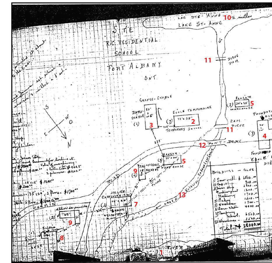
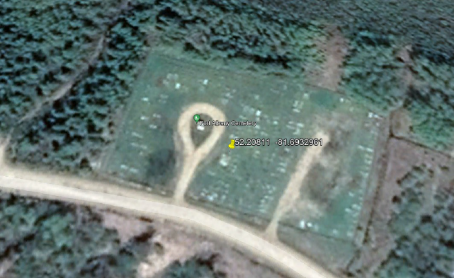
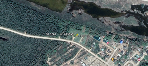
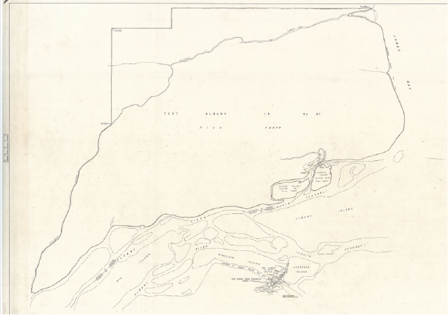
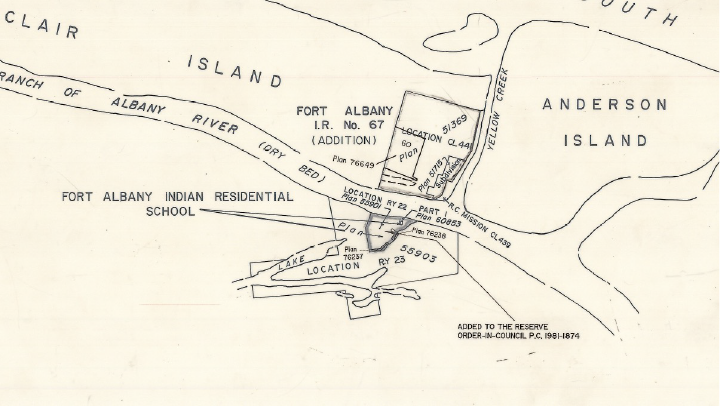
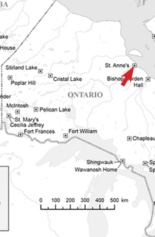
St. Anne’s

St. Anne’s (Fort Albany)

1906-1976
Operated by Roman Catholic Church

St. Anne’s Indian Residential School opened at Fort Albany, ON in 1906. The school was located at the Roman Catholic Mission on Albany Island from 1906 to 1932 when it was relocated to a site about a mile from the confluence of the Albany and Yellow rivers. This new school burned down in 1939 but was rebuilt. Three boys who escaped from the institution by running away in 1941 were never found. Since its closing, a number of Survivors have come forward as witnesses to abuse and deaths at the school, and several former staff members have been convicted of a range of offences including indecent assault, assault causing bodily harm, assault, and administering a noxious substance. The Federal Government took over the operation of the school in 1965. The school’s residence, which Canada took over in 1970, was closed in 1976 when the school was transferred to the local First Nation.

Click each image below for a larger view.

Cliquez sur chaque image pour l’agrandir.

Photographs by Paul Lantz uploaded in 2011 illustrating the Cemetery at Fort Albany (A), the Roman Catholic Mission (B), and the Roman Catholic Convent (C). The latter building was burned down after the photo was taken. These images are copyrighted to the photographer.


1 Cemetery (see Lantz 2011)
2 Roman Catholic Mission (abandoned) (see Lantz 2011)
3 Roman Catholic Convent (burned) (see Lantz 2011)


Location One:
On Albany Island

On Albany Island, probably near the southern shore. Location is rough estimate only. Extract from: Google Earth 52°14’12.53″N 81°36’22.04″W [estimated in the area of]


Location One:
On Albany Island

Longer view of the vicinity of Albany Island, site of the first Catholic mission and school. Extract from: Google Earth 52°14’12.53″N 81°36’22.04″W [estimated in the area of]


Location One:
On Albany Island

Map showing missions on Albany Island, ca 1912. Extract from: Natural resources Canada, I.R. Near Fort Albany, Dist. Patricia, 1912, T2074 CLSR ON. https://clss.nrcan-rncan.gc.ca/clss/plan/detail?id=T2074%20CLSR%20ON


Location One:
On Albany Island

Closeup of map showing missions on Albany Island, ca 1912. Extract from: Natural Resources Canada, I.R. Near Fort Albany, Dist. Patricia, 1912, T2074 CLSR ON. https://clss.nrcan-rncan.gc.ca/clss/plan/detail?id=T2074%20CLSR%20ON


Location One:
On Albany Island

Plan showing the approximate location of the Hudson’s Bay Company Post on Albany Island. Extract from: Natural resources Canada, FN’S & Report OF I.R. Near FT. Albany, 1912, FB619 CLSR ON. https://clss.nrcan-rncan.gc.ca/clss/plan/detail/id/FB619+CLSR+ON

1 Cemetery
2 Roman Catholic Mission (abandoned)
3 Roman Catholic Convent (burned)
4 Possible area of Ste. Anne’s IRS.

There seems to be two candidate sites for the now destroyed IRS. The cemetery, likely associated with the Catholic church and larger community is located at 1 above. No indication of a separate school cemetery was observed.


1 River Bank (?)
2 Temporary School
3 Barn, Stable
4 Foundation of Old School
5 Warehouse
6 Bakery
7 Carpenter’s Shop
8 Sawmill
9 Atelier (?) (workshop)
10 Lake St. Anne
11 Dam
12 Bridge
13 St. Anne Lake Creek

Sketch plan of Ste. Anne’s IRS (Auger 2005:112)


Location Two
Satellite view of cemetery. Extract from: Google Earth 52.20811  -81.6932961


Location Two
Longer view of cemetery and surrounding area. Extract from: Google Earth 52.20811  -81.6932961


Location Two
Plan showing location of school, ca 1978. Extract from: Natural Resources Canada, I.R. 67 and Residential School, 1978, 64885 CLSR. https://clss.nrcan-rncan.gc.ca/clss/plan/detail?id=64885%20CLSR%20ON


Location Two
Close up from plan showing location of school, ca 1978. Extract from: Natural Resources Canada, I.R. 67 and Residential School, 1978, 64885 CLSR. https://clss.nrcan-rncan.gc.ca/clss/plan/detail?id=64885%20CLSR%20ON

Additional Resources

Ressources supplémentaires