Sacred Heart

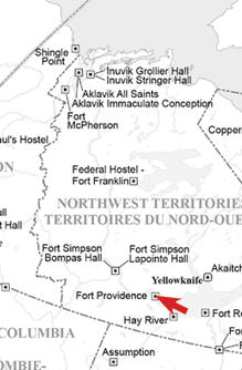
Sacred Heart IRS (Providence Mission) Ft. Providence
1906-1960
Operated by Roman Catholic Church

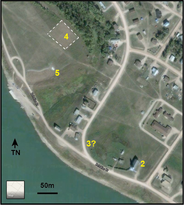
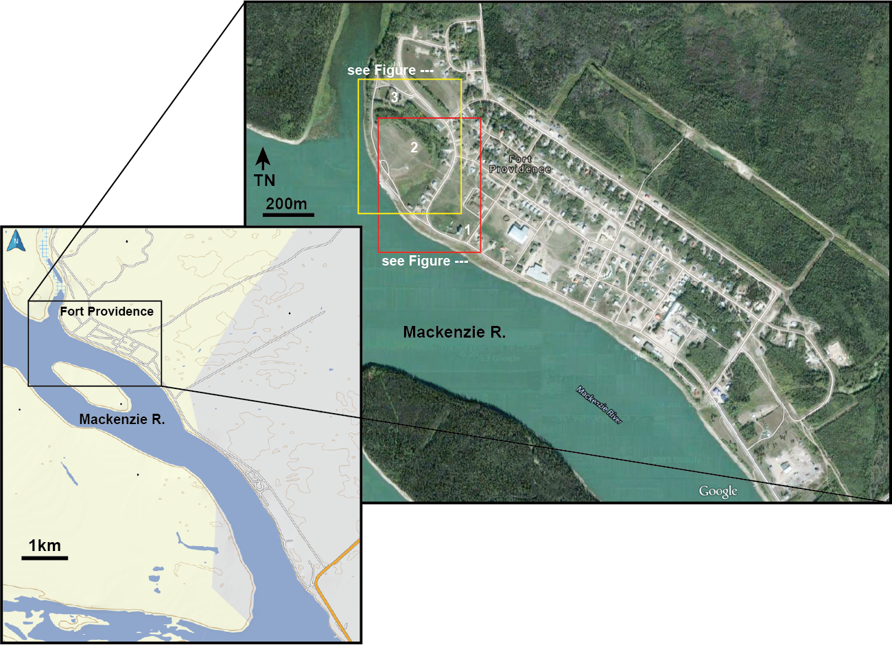
Opened in 1867 as a mission school (Sacred Heart), with expansion of original log buildings in 1912. A three story building completed in 1930. The cemetery associated with the early mission and school is located upon the top terrace over river with the oldest recorded burial being in 1868, and the last in 1929, shortly before the move to the new school. With the 1924 establishment of a new church, a new cemetery was opened at the east end of town on a higher terrace. Children who died while attending the second IRS are likely buried in the new cemetery. In 1948 the bodies of deceased Priests and Nuns were exhumed from old cemetery and reburied in the new one. The old cemetery location then became used for agriculture. Through a local initiative it is now protected within a fence and some GPR work. was conducted in the late 1990s.

Click each image below for a larger view.

Cliquez sur chaque image pour l’agrandir.

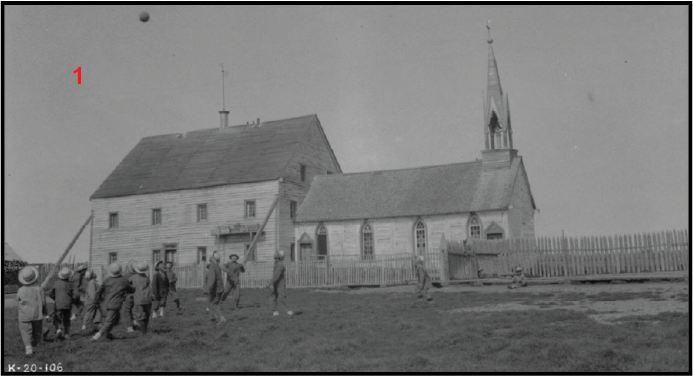
Ft Providence Mission Church ca. 1920 (www.bac-lac.gc.ca).


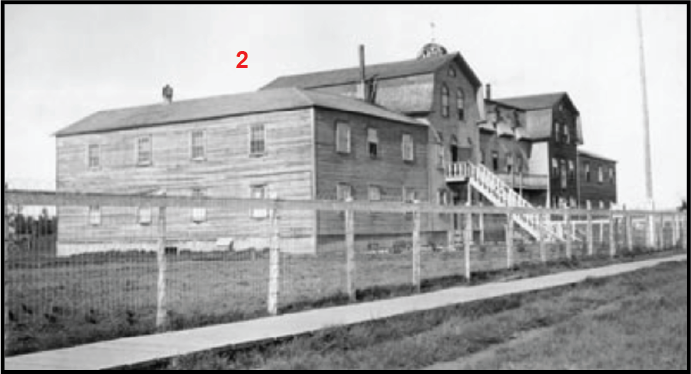
Ft Providence Indian Residential School ca. 1922 (NWT Archives/G1979-001-0152).


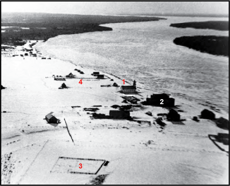
Oblique angle air photo looking south across Fort Providence prior to 1929 (Moorman nd)

1 Church
2 Residential School
3 Old Cemetery enclosed with a fence (note it is located south of the old Oxbow Channel
4 HBC Store Compound


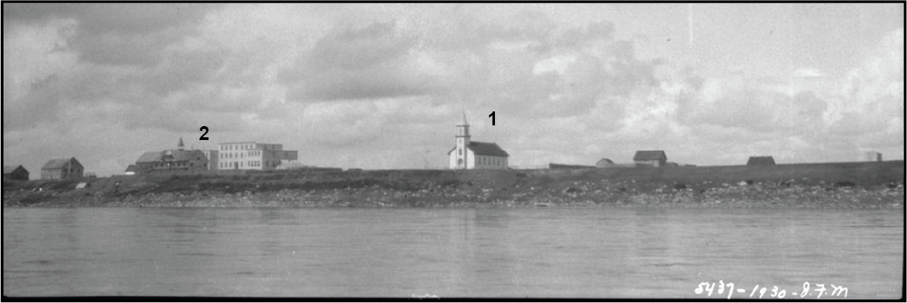
View looking north from Mackenzie River towards church (1) and the Indian Residential School Complex (2) ca. 1930s). (F. Moran, Library and Archives Canada, PA-102472)


1 HBC Store complex
2 All Saints Roman Catholic Church
3 Residential School
4 Old Cemetery subjected to GPR survey
4? Approximate location of old cemetery, located south of the Oxbow Channel
4? Approximate location of new cemetery, located north of the Oxbow Channel


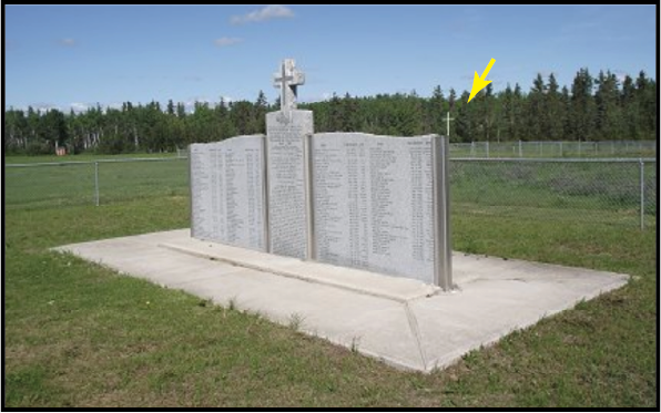
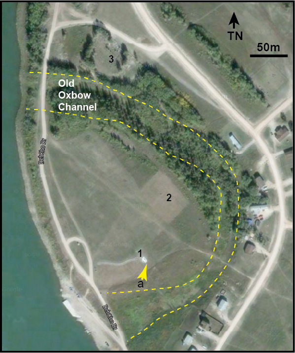
Memorial Monument (location 1) to people buried in the old cemetery that remained in operation until 1929. Note cross in background (arrow) that marks the cemetery area (location 2). Note orientation arrow a.


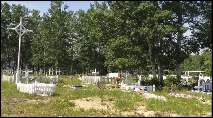
‘Frame grab’ of a Youtube video of new cemetery at Fort Providence (likely location 3).


1 Memorial to the deceased buried in the old cemetery (2).
2 Old cemetery area that was cleared for GPR survey shortly before the satellite imagery was collected.
3 Probable new cemetery (used after 1929) located north of the old oxbow channel illustrated by Taylor (1945:210).


2021 Bing Satellite image of Cemetery location 3 (more recent cemetery), located north of the oxbow.

1 All Saints Roman Catholic Church
2 Original Cemetery
3 Current Cemetery (possible)


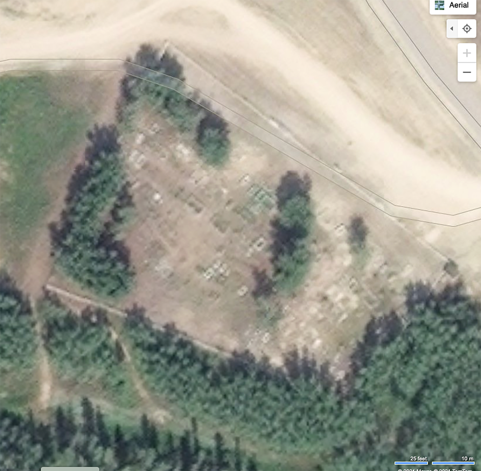
2021 Bing Satellite image of original cemetery (4), with the monument (5) located to the south.


Fort Providence in ca. 1944 (after A. Maass’ report citing Taylor 1945:210)


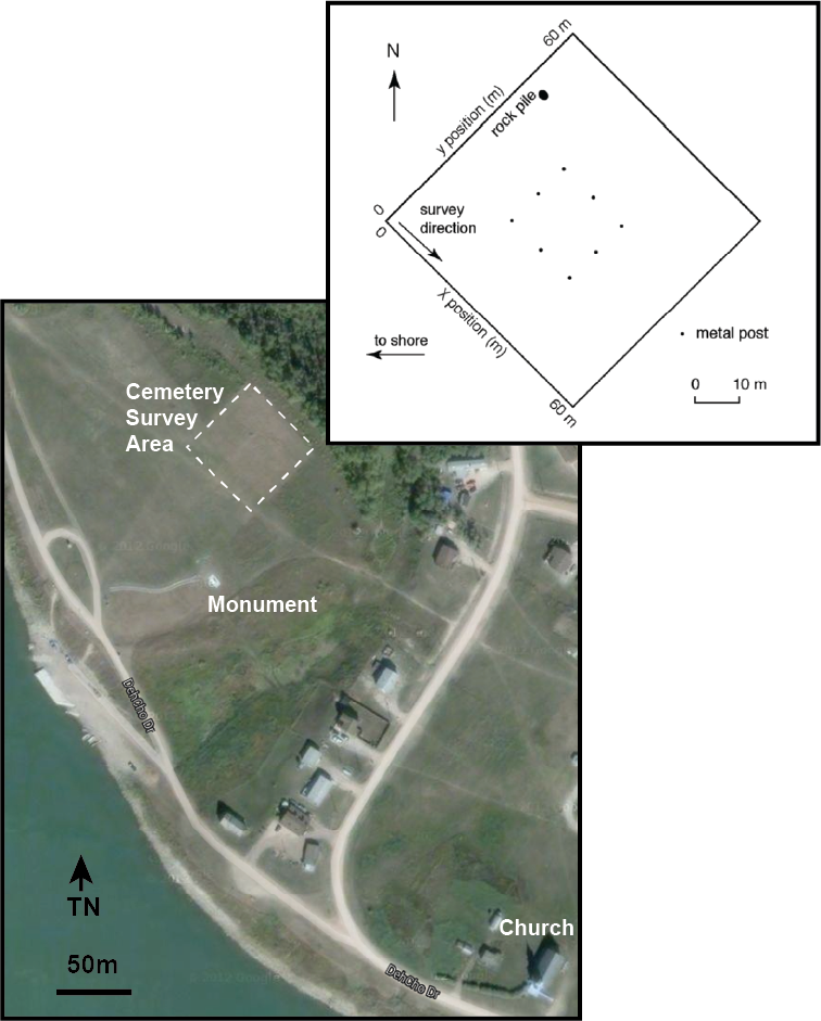
The GPR survey area is 60 by 60 m surrounding a central area believed to contain the old cemetery that was previously delimited with metal posts. The area beyond the posts was investigated in search of unmarked graves that might lie beyond this limit.


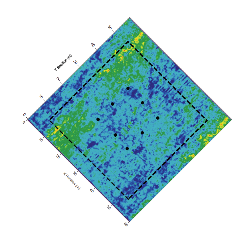
Example GPR output that identifies a number of poorly delimited anomalies or unconformities, many of which may represent closely packed grave shafts. Interpretation of such data is often complicated, requires considerable expertise, and sometimes requires ‘ground proofing’ to determine the source of the unconformity.

GPR survey maps derive from Moorman (nd) who conducted a survey in 2003 to help define the location of graves within this cemetery.

The GPR output illustrated above is difficult to interpret. This likely reflects the nature of the survey methodology and the data filtering and visualization software available at the time. While the latter has significantly improved, it serves to make the point that data interpretation requires considerable expertise and experience.

Additional Resources

Ressources supplémentaires